Romero to Cold Spring
Today my buddy Tom Quisel and I rode Romero Trail up to East Camino Cielo and across to Cold Spring Trail. It’s a fanastic ride: a solid tempo climb up to the ridge line graced with unbelievable views of the Santa Barbara coastline south, followed by a tech descent back into town. The ride reminded me of the all day epics I used to do as a grom in the Cleveland National Forest. Unfortunately, I didn’t get any photos during the ride. Too bad, because it was a stunner.
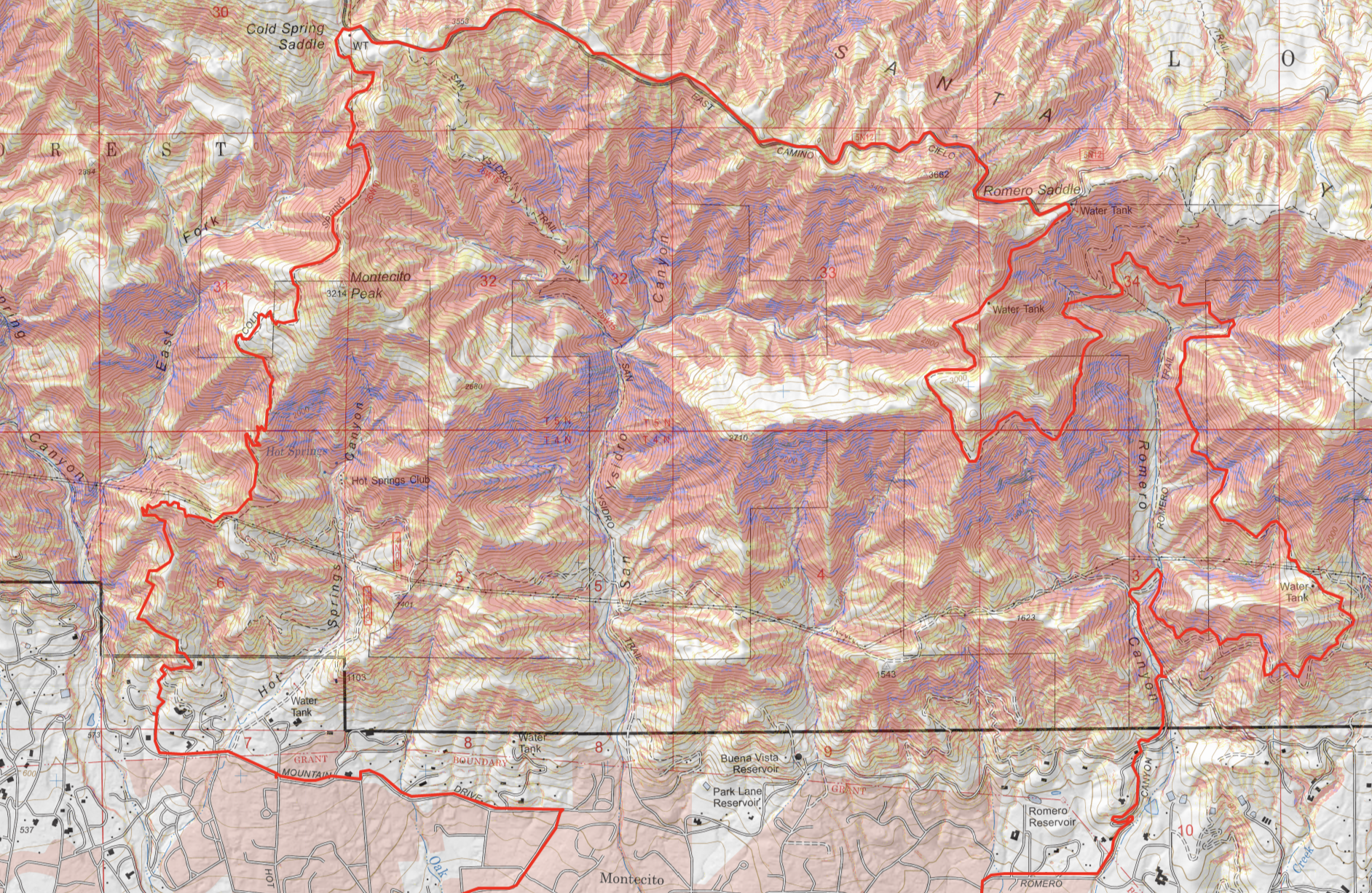
Following the ride I had a few minutes to map out the route on Cal Topo. If you haven’t checked it out, it’s an extremely cool backcountry mapping tool. Below are a few stats from the ride, as well as the topo itself. I’m curious how Cal Topo defines the “land cover merics”, as 59% of he ride being designated as “Developed” seems dubious by my definition. The slope angle percentages also are suprisingly steep. I’d like to ge my hands on the raw latitude, longitude, and elevation time series so I can corroborate some of these metrics myself. Alas, a project for another day.
A few stats from the ride. 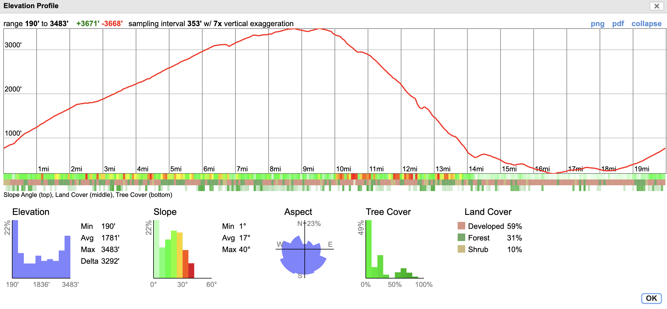
The Topo (check out the link above)